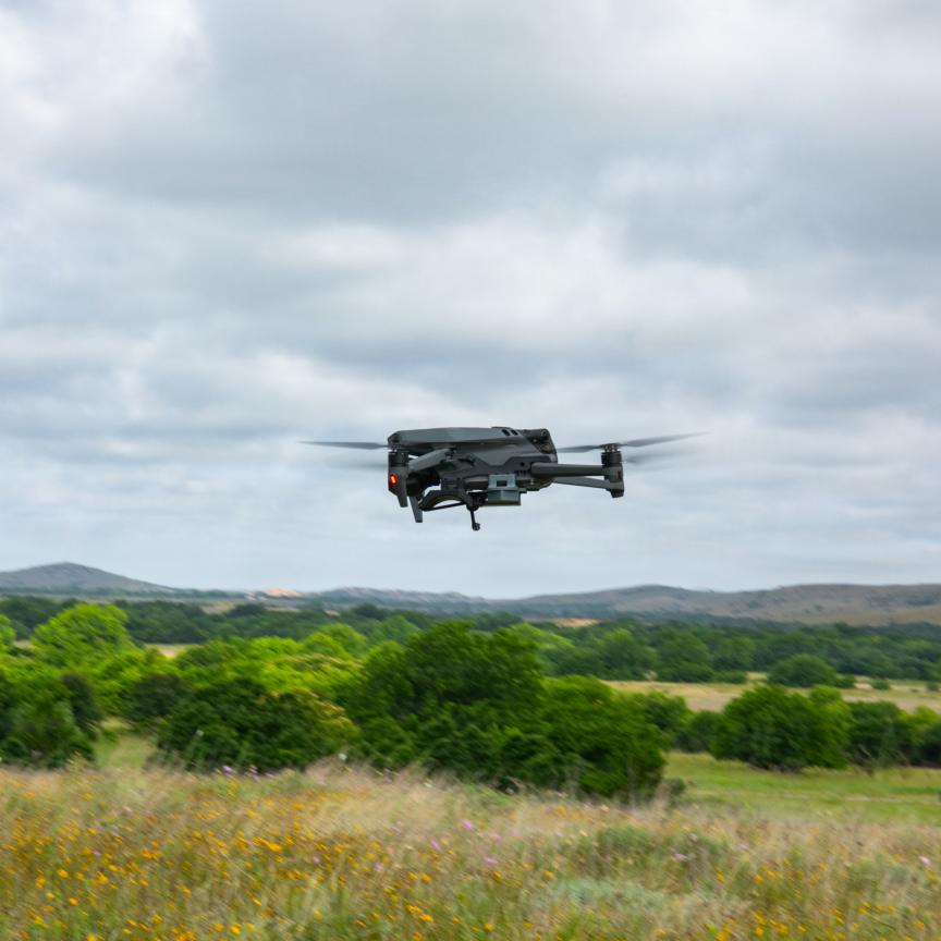
During the past 25 years, geographic information systems (GIS) and their related technologies – GPS, digital mapping, remote sensing, geovisualisation, photogrammetry and cameras, to name a few – have undergone quite a speedy evolution. More recently, the development of location-based services like Google Earth, web-based and mobile GIS applications, and the resurgence of remote sensing using unmanned aerial vehicles (UAVs), have all added to the prevalence of GIS.
According to David Green, director of the UAV Centre for Environmental Monitoring and Mapping (UCEMM) and director of the MSc in GIS degree programme at the University of Aberdeen in Scotland, remote sensing is one of the key components of what is defined as GIS, and as a major source of imagery and image data – both photographic and video – specifically about the environment. Overall, remote sensing generates valuable data and information for integrated analysis with other sources of geospatial data.
‘Remote sensing and digital image processing are not new, but the rapid growth in ready-to-fly UAVs and the associated softcopy photogrammetry and specialised UAV image processing software have changed what can be acquired, how, when and where,’ explained Green. He added that softcopy photogrammetry – the method of collecting topographic data for mapping – offers new visualisation opportunities to build 3D models of terrain and the landscape.
‘There are now also many developments in software, hardware and navigation associated with UAV technology,’ Green said. ‘This, together with small affordable sensors such as lidar, Bathymetric lidar, thermal and hyperspectral, provide unprecedented opportunities for the acquisition of low-cost, high-resolution data that can be inputted into GIS software.’
Green also believes that ready-to-fly (RTF) UAV platform and sensor developments and their very rapid evolution are providing a wide range of opportunities for individuals to gather and process their own data and information about the environment. He added that a large proportion of geospatial technology is becoming part of desktop and mobile computers, making it more plug-and-play and opening it up to areas outside the domain of the specialist.
‘Small companies and individuals have been empowered by the affordable, low-cost, easy-to-use hardware and software now available to collect, process, analyse, visualise and communicate geospatial information for a wide range of environmental uses,’ Green asserted.
Vladimir Plšek, technology manager at TopGis, a company based in the Czech Republic, agreed that there have been several crucial moments in the last several decades that have redefined traditional mapping approaches, and opened up the market to non-professionals. The first is the shift from optical and analogue devices to digital ones, which effectively changed the traditional technological chains and allowed more effective data processing. This was accelerated by developments in computer processing performance. But the most revolutionary change, he said, came when GPS technology was declassified as a military tool and made available to the public.
‘Complemented by the internet’s availability and permeability, the declassification of GPS can be viewed as the real revolution,’ Plšek explained. ‘Laymen can become users of mapping technologies without having a clue of what surveying, mapping and geography are about. When we recognise the amount and variety of devices that are equipped with a GPS chip and connected to internet networks, it’s difficult to imagine the amount of data unintentionally collected, processed all over the world and presented through GIS systems – and accepted as an obvious part of our consumed information.’
Camera considerations
As a company, TopGis focuses on aerial imaging, oblique aerial imaging and mobile mapping technologies, complemented with lidar technology to document the surrounding world for both the public and professionals. In order to deliver high quality data quickly, efficiently and at a low cost, and essentially commercialise geographic data, a high-resolution camera suited to GIS is important.
Various vision companies like JAI and Point Grey are active within this market, with JAI supplying 18 of its high-resolution five-megapixel JAI SP-5000C-GE2 cameras to TopGis for use in a mobile mapping car. This camera was chosen according to a strict list of parameters that included the size of the chip, a high frame rate, a global shutter, the ability to download data quickly and easily, and the capacity to trigger the camera by a transistor-transistor logic (TTL) pulse emanating from the positioning system.
Point Grey’s spherical cameras are pre-calibrated with six sensors and incorporate all aspects of a 360° imaging system. The cameras also include a software package that manages the image acquisition, real-time processing, and image stitching needed to create a single panoramic snapshot. Customised solutions are available to users that wish to integrate multiple single sensor cameras and use the Point Grey’s software development kit to manage image acquisition and stitching.
Nathan Cohen, North American business development manager at Imperx, commented that the demand for his company’s cameras for GIS is a growing field. ‘There are many challenges that can be solved with larger format cameras,’ said Cohen. ‘Many people think of GIS technology as simply mapping, but there are several other applications that benefit, such as situational awareness, emergency response, agriculture, and other interesting applications.
‘Most people think of GIS as simply taking an image of the ground for analytics; however, there are always creative solutions to solve unique needs utilising combinations of lensing, filtering and multiple cameras. The right combination can optimise farming by determining nitrogen in soil, or monitoring crop health to optimise fertilisation or pest control,’ he added.
The Imperx large format cameras are heavily involved in GIS applications, and in both geospatial and terrestrial applications the largest resolutions are generally the most demanded. Overall performance of the sensors is extremely important, and Cohen commented that all GIS applications look for sensors with low noise, high dynamic range, excellent sensitivity and global shutter technology. Low noise and good sensitivity tend to be the most sought after properties, thanks to the speed at which the imager is collecting data.
Camera features such as precise timing and synchronisation capabilities are useful in syncing with the imaging hardware and, most importantly for GIS, the camera must be able to survive flight or launch, a fluctuating temperature range and overall harsh environments. ‘Many cameras, because of weight restrictions on small airframes, are simply attached to the airframe with very little protection,’ said Cohen. ‘Consequently, an investment of a durable camera means that the customer will not be repeatedly purchasing expensive cameras as a result of failures.’ Imperx customers have tested cameras in excess of 1,500g shock and 100g vibration.
Imperx cameras contain FPGAs with a large feature set, and many of those features can be set up for autonomous use with programmable limits. For example, auto-exposure control can have a minimum and maximum exposure time, while the auto-gain can be programmed with limits. Users can program gain and exposure settings to target an average or maximum image intensity, and multiple camera input/outputs are developed to communicate with other cameras, GPS or inertial measurement units (IMUs) for precise georectification of an image.
Furthermore, to eliminate motion smear, the integration times must be extremely short – which can create a challenge achieving the sensitivity or dynamic range required for a useful image. To tackle this issue, Imperx has integrated programmable time-delay integration (TDI) into its largest area scan sensors to allow multiple exposures of the same moving object.
Cohen believes that GIS technology will continue to improve because of the development of larger, faster sensors. ‘With the latest release of a 47 megapixel CCD sensor from On Semi, this will either double the overall resolution or double the spatial resolution. Therefore, in terrestrial flight, the flight could require half the time to map the same area with a single camera,’ he said.
Virtual thinking
Looking to the future of geographical information systems, TopGis’ Plšek highlighted that there have been many attempts to make GIS devices fully three dimensional and to present GIS data in the form of 3D interactive visualisations. TopGis’ latest developments aim to interweave the GIS world with the gaming and simulation world.
‘The virtual terrains used in games and [not only] military simulators look very real, but do not reach the real-world details needed in GIS. And the scene realism is often the part of GIS applications that’s lacking,’ Plšek explained. ‘Our goal is to connect those two separate worlds and to use the scene generators of virtual reality for games and simulators to process pure GIS data and bring it to daily use.’
He continued by asserting that there will always be a need for traditional GIS data collection technologies, and predicted an enormous boom of behavioural GIS analyses based on continual and fully automated data collection from smart phones, camera systems and other sensor networks. He also believes that GIS databases, based on crowdsourcing, will challenge the commercial ones – and that the move will be strongly supported by the open source geo-community.
However, Plšek also warned that while it’s true that mapping and GIS technologies are becoming a mass affair, the technologies and tools being used are often simple ‘black boxes’. ‘This means many people can use the technology and have it work, but they do not understand the basics of geodesy, surveying, mapping, coordinate systems, photogrammetry, and all the related elements,’ he said. ‘This can have serious consequences and harm the profession itself.’