AI combines with physics to provide accurate imagery of future natural disasters
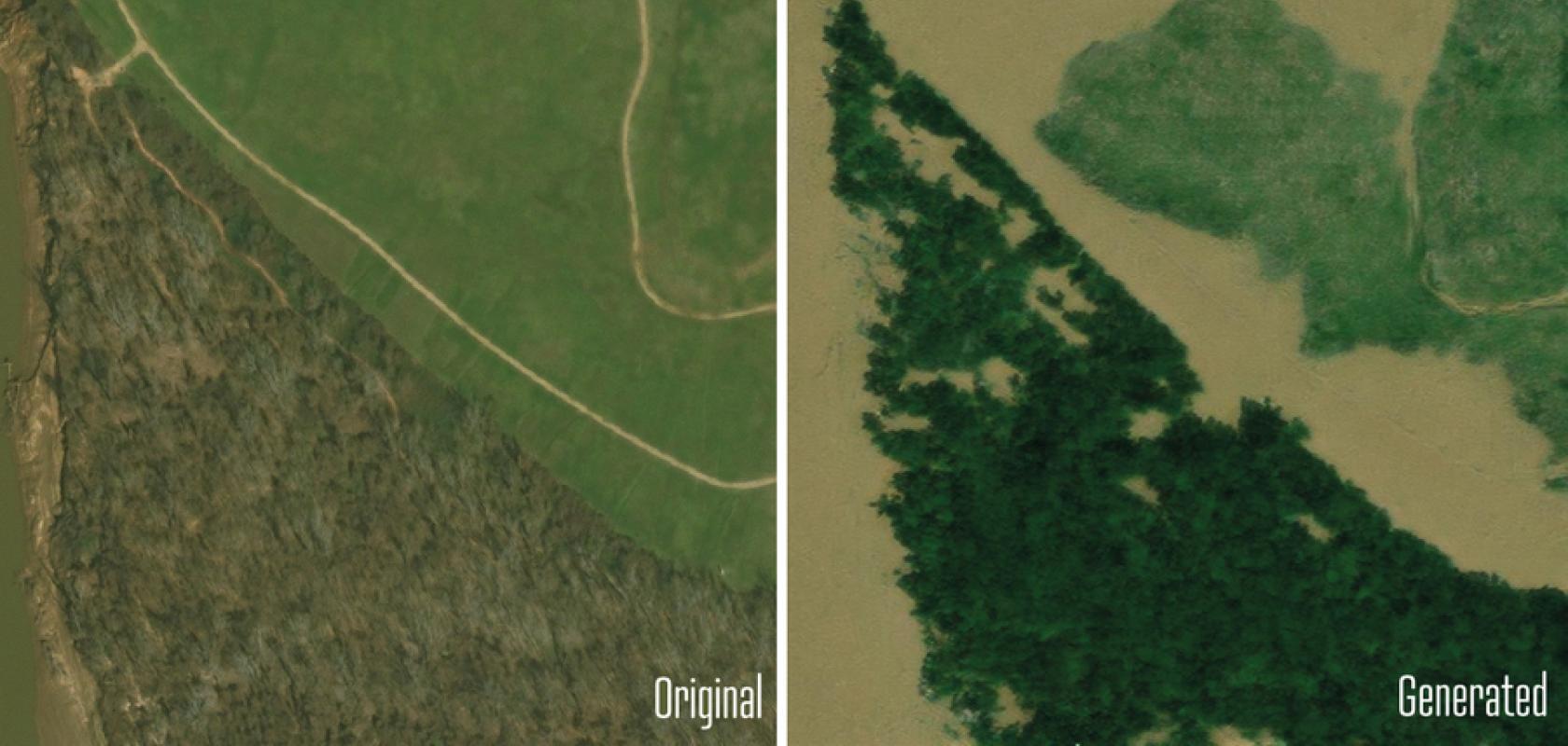
Earth Intelligence Engine-generated imagery of flood impact in Houston. Image: Pre-flood images from Maxar Open Data Program via Gupta et al., CVPR Workshop Proceedings. Generated images from Lütjen et al., IEEE TGRS
The Earth Intelligence Engine feeds details of an oncoming storm into a physics-based flood model, then uses generative AI to create realistic satellite imagery to predict the likely impact.
Register for FREE to keep reading
Join 10,000+ vision professionals driving innovation in automation, AI and imaging with:
- Expert insights on vision, robotics, AI & embedded tech
- Newsletters and features covering the full imaging landscape
- Visionaries series: leadership strategies in imaging
- Free panels on smart manufacturing & autonomy
- White Papers & updates for smarter integration
Sign up now
Already a member? Log in here
Your data is protected under our privacy policy.