A satellite containing a powerful UV laser and custom CCD detector for measuring wind speed has been launched into space yesterday. The European Space Agency’s (ESA) Aeolus spacecraft will provide detailed profiles of the Earth's winds in near real-time to improve the accuracy of weather forecasts.
The measurement payload onboard Aeolus is the Atmospheric Laser Doppler Instrument (ALADIN), which works by emitting an ultraviolet laser beam through the Earth’s atmosphere and measuring the reflected return signal from particles, or aerosols in the atmosphere.
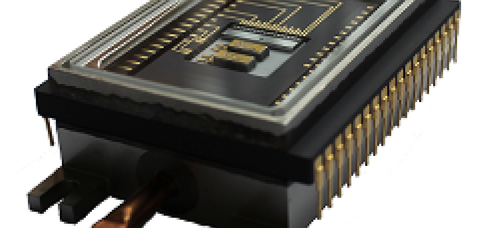
The returning light is detected by a custom CCD sensor made by Teledyne e2v, in Chelmsford, UK. Teledyne e2v, in collaboration with Airbus Defence and Space, which built the satellite, and ESA, developed a detector that simultaneously measures the distance of the returned ultraviolet laser pulse to resolve the altitude of aerosols in the atmosphere, and the Doppler shift that equates to the wind speed at each altitude.
The returned signal is typically extremely weak. However, the detector has the capability to add together a number of returned pulses to improve the accuracy of the measurements. Aeolus is the first satellite of its kind to use this type of technology in space.
Credit: ESA/ATG medialab
Teledyne e2v’s detector consists of a 16 x 16-pixel CCD with a novel storage region that accumulates the signal from several successive laser pulses. The detector is housed in a hermetically sealed package with an integrated thermoelectric cooler (TEC) that uses the Peltier effect to transfer heat away from the sensor. The CCD detector is optimised through a backthinning process to provide a very high detection efficiency at the laser wavelength of 355nm.
Meteorologists will be able to use the wind speed and atmospheric pressure change data to make more accurate global weather forecasts and understand better the processes relevant to climate variability. Accurate weather forecasts are also important for commercial undertakings such as farming, fishing, construction and transport.
James Cotton, satellite winds scientist at the Met Office, said in a statement: 'The Aeolus mission aims to improve the global coverage of wind profile observations, including areas where in situ wind measurements are currently lacking, such as over the oceans, in the tropics and the Southern Hemisphere.
'Within numerical weather prediction, we expect the Aeolus winds to be particularly useful for improving our analysis of the atmospheric state in the tropics, a region where we know the model wind errors are large,' he added.
The Aeolus satellite is now in low orbit and will have a life span of approximately three years.
The Atmospheric Laser Doppler Instrument (Aladin) is one of the most sophisticated instruments ever to be put into orbitCredit: ESA/ATG medialab
Top image: Teledyne e2v’s detector