Two unidentified, possible pyramid complexes have been located with satellite imagery from Google Earth.
One of the complex sites contains a distinct, four-sided, truncated, pyramidal shape that is approximately 140 feet in width. This site contains three smaller mounds in a very clear formation, similar to the diagonal alignment of the Giza Plateau pyramids.
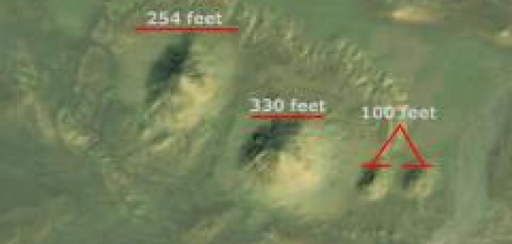
The second possible site contains four mounds with a larger, triangular-shaped plateau. The two larger mounds at this site are approximately 250 feet in width, with two smaller mounds approximately 100 feet in width. This site complex is arranged in a very clear formation with the large plateau, or butte, nearby in a triangular shape with a width of approximately 600 feet.
The sites have been documented and discovered by satellite archaeology researcher Angela Micol of Maiden, North Carolina. Micol has been conducting satellite archaeology research for over ten years, searching for ancient sites from space using Google Earth. Google Earth has allowed her to document many possible archaeological sites, including a potential underwater city off the coast of the Yucatan peninsula that has sparked the interest of scientists, researchers and archaeologists.
The Egyptian sites have been sent to Egyptologists and researchers for further investigation and ‘ground truthing’. Micol stated: ‘The images speak for themselves. It’s very obvious what the sites may contain, but field research is needed to verify they are, in fact, pyramids and evidence should be gathered to determine their origins. It is my hunch there is much more to these sites and with the use of infrared imagery, we can see the extent of the proposed complexes in greater detail.’
Many of the documented areas will remain undisclosed until proper officials are notified and the sites can be protected.