Satellite Vu has raised a £3.6m ($5m) seed round to launch a satellite constellation capable of imaging the thermal footprint of any building on the planet every 1 to 2 hours.
This capability could help countries reach emission targets, by monitoring - in near real time - energy being wasted by poorly insulated buildings, or the economic activity of factories and the power generated by power stations.
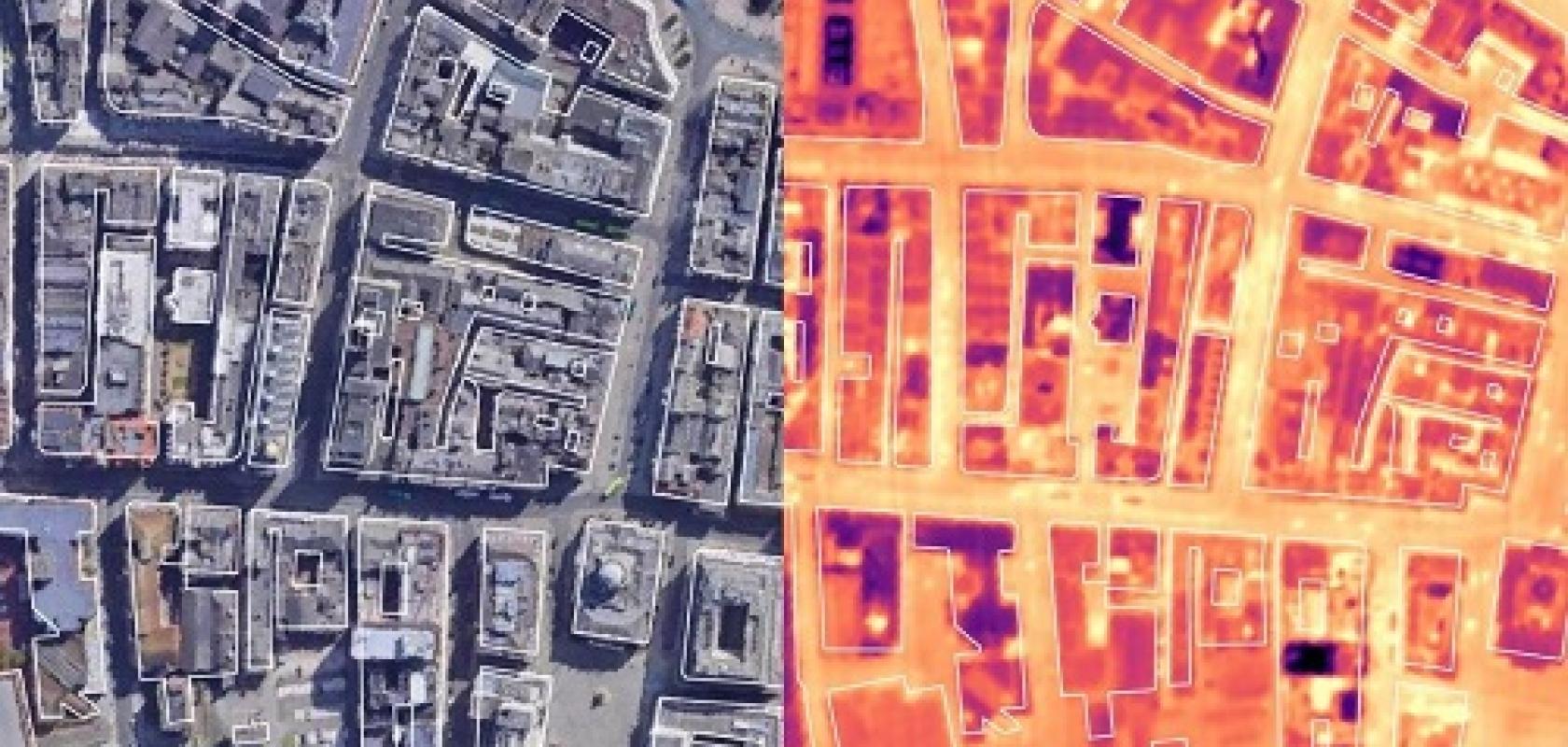
Satellite Vu’s constellation of small satellites - around one tenth the size and cost of standard infrared imaging satellites - will be able to resolve objects 3.5m in size in stereo mid-wave infrared imagery. They will also be able to collect mid-infrared videos in one-minute intervals, and measure the heat signature of any building multiple times a day.
According to Anthony Baker, CEO of Satellite Vu, the technology will 'allow the government and the public to make better and informed decisions on which buildings are a priority to upgrade,' he said. 'The lessons learnt from the pandemic were: test, test, test; in the climate change challenge we need to: measure, measure, measure.'
James Bruegger, managing partner of Seraphim Capital, which led the seed round, said: 'We believe that high resolution infrared satellite data holds enormous promise for positively impacting the world. A combination of poor resolution, high cost and infrequency of data capture has held back the application of this high impact dataset for decades. We’ve backed Satellite Vu because it alone has the technology to address all these issues and make high resolution infrared the next major category of space data.'
Gregory Dewerpe, founder of A/O Proptech, which also supported the seed round, said: 'With the built environment responsible for almost 40 per cent of global carbon emissions, it is crucial that the sector harnesses new technologies if we are to rapidly reduce our carbon footprint. Using accurate data is vital to making informed decisions, and Satellite Vu has found a way to measure the thermal efficiency of buildings which has never been carried out before at scale.'
The funding round means Satellite Vu can start building its first satellite, which is set to launch in 2022.
Satellite Vu has been backed by the UK Space Agency through its National Space Innovation Programme to support the build of the infrared sensor for its first satellite, and has also partnered via the Sprint programme with the University of Surrey to evaluate the utility of infrared observations in the maritime domain.