Imaging outside of the visible spectrum, whether in the ultraviolet or infrared, can tell you a lot about an object that might not otherwise be seen with visible light. Inspection of fruit and vegetables in infrared, for instance, can expose bruises and rotten areas under the skin that wouldn’t necessarily show up with standard colour imaging. Cameras like JAI’s LQ-200CL 4CCD colour line scan camera, which has four sensors providing an additional near-infrared (NIR) channel to the standard red, green, and blue, is designed for just such an application. Other systems are available offering greater numbers of channels – German company Chromasens has recently released a camera system with 12 spectral channels on a single sensor, providing highly accurate spectral analysis of different colours for tasks like print inspection.
Spectral imaging combines spectroscopy with imaging, whereby spectral information is captured at the pixels of a sensor. The systems typically have numerous channels covering different wavelength ranges, rather than merely the three bands of RGB colour. Related but distinct techniques include multispectral imaging, that is, the sensor images at a number of discrete wavelength bands, and hyperspectral imaging, in which the sensor still images at discrete bands – but over a continuous wavelength range. As an example, pixel lines on a hyperspectral sensor covering the short wave infrared (SWIR) range would analyse a band, say, between 1.4 to 1.5μm for the first line, 1.5 to 1.6μm for the second, 1.6 to 1.7μm for the third, and so on. Multispectral imaging, on the other hand, might measure at specific wavelength bands, with the incoming light partitioned with filters, but it wouldn’t be over a continuous range.
Both techniques are often used in remote sensing projects, such as satellites monitoring Earth. Infrared detector manufacturer Sofradir, which has its headquarters near Paris, France, has provided both multispectral and hyperspectral detector arrays for space projects. It has supplied its Saturn 1,000 x 256 pixel 30μm pitch SWIR detectors for the Italian-led PRISMA (Precursor Hyperspectral Mission Application) satellite programme, a system of Earth observation hyperspectral imagers currently under development.
‘The objective of the PRISMA project, as for a lot of hyperspectral space missions operating in the SWIR, is monitoring the Earth’s water cycle,’ says Philippe Chorier, head of space projects at Sofradir. ‘In the short wave band there are a lot of wavelengths at which water absorbs radiation. The data provides a map of Earth’s humidity levels and this, in turn, provides data on vegetation as well as agriculture.’
Molecules such as water will have a spectral fingerprint that will signify its presence at specific wavelengths of light. Hyperspectral imagers capture a set of images each comprising a spectral band, which are then combined into a 3D data cube and from the signal intensity at the wavelengths corresponding to water molecules, humidity levels in the scene can be determined.
Hyperspectral imaging is also used in mineralogy to provide data on the chemical composition of rocks and areas of land. Environmental disasters, such as oil spills, can also be monitored with the images showing the evolution of oil concentrations in the ocean.
PRISMA will aim to generate information on land cover, crop status, pollution quality of inland water systems, the status of coastal zones and the Mediterranean Sea, soil composition, and the carbon cycle, monitoring specifically Europe and the Mediterranean region.

Image of the French Frigate Shoals, an atoll consisting of a 35km crescent-shaped reef located in the Pacific Ocean about 800km northwest of Honolulu, Hawaii. The image was acquired with the Compact High Resolution Imaging Spectrometer (CHRIS) onboard the European Space Agency’s Proba-1 satellite, designed to acquire hyperspectral images with a spatial resolution of 17m across an area of 13km. Credit: ESA
Sofradir’s detectors used in PRISMA have 256 lines, providing a spectral resolution at up to 256 wavebands covering visible, NIR and SWIR ranges (0.4-2.5μm). ‘The key challenge is positioning the optical components in front of the detector to partition the light into 256 different wavebands,’ says Jacques Chautemps, sales and marketing manager for space applications at Sofradir. ‘There are two ways to do this: either a prism or a grating that selects, for example, 100 wavebands of interest.’
Chautemps comments that another important feature of the detector is that the gain can be selected for each line. ‘Within a spectrum of radiation, there are both faint and intense signals reaching the detector depending on the emission or absorption of the molecule,’ he says. A small gain is used if the signal is strong, while a large gain is required for a faint signal. The precision of the detector is therefore very good, as it can adjust the gain for each pixel line and gather information even for a very faint signal.
Knowing when to harvest
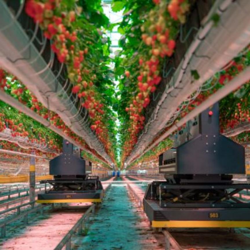
Spectral imaging from space can provide data on the vegetation cover of the land and even the optimum harvest time for a field of corn or wheat. To the same effect, monitoring the chemical composition of the soil in a field is also possible using this imaging technique. Maps of variables such as water and nutrient levels along with pest infestations allow farmers to take rapid, targeted action, which minimises cost and environmental impact while maximising crop yields.
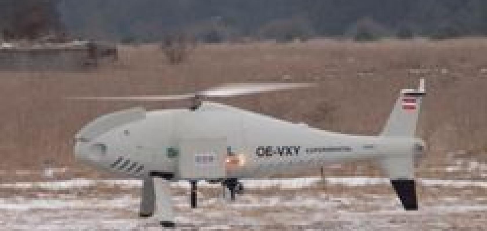
An environmental monitoring project by Carinthian Tech Research, a non-university R&D centre based in Austria, has made use of multispectral cameras from Dutch company Quest Innovations to classify different land types and calculate vegetation indices. The multispectral imaging system was mounted on a Schiebel unmanned aerial vehicle (UAV) and could simultaneously capture three visible and two NIR channels.
The aim of the project was to develop a technique for classifying vegetation cover from multispectral images taken from the UAV at a height of around 100m. The images were analysed with the Normalised Difference Vegetation Index (NDVI) algorithm, commonly used to analyse satellite image data in assessing vegetation cover. Test flights were made in January and February 2010, with the resultant images providing an accurate assessment of vegetation cover.
‘Multispectral imaging combines spectral information with machine vision information,’ explains Richard Meester, president and CEO of Quest Innovations. ‘It could be thought of as basically 3D imaging, where the third dimension is not a height profile, but rather is spectral information. Spectroscopy provides single points of data. The spectral information is combined with the visible information of a 2D image at each pixel.’
The camera used in the environmental monitoring project has five channels – RGB, plus two infrared channels – providing five points where the spectral response could be measured at each pixel.
‘Separately, the five channels provide five greyscale images,’ Meester continues, ‘which from a contour level are similar, but from an intensity level – from black to white – look different. Vegetation reflects infrared light at a different intensity from soil, for instance, and therefore we were able to detect regions with vegetation and those without.’
Meester comments that in a multispectral camera, all sensors have to register light through the same lens. To achieve this, these cameras use a prism to separate the light while still using the same optical axis. ‘The sensors have to be aligned carefully so that they all register the same image,’ he says. ‘For three channels (RGB), this is relatively simple. To have a greater number of fine-grained spectral regions, there have to be more channels and therefore more sensors have to be aligned. With each additional sensor there is an increase in the complexity of the system.’

A hyperspectral data cube revealing the ‘spectral depth’ of an image and showing the full electromagnetic spectrum in many narrow contiguous bands. Hyperspectral data provide detailed information for disciplines such as environmental monitoring, resource management and crop classification. Credits: DLR
Currently, Quest Innovation supplies a five-sensor camera and the company plans to release a six-sensor system later on in the year. The company is also investigating systems with up to 20 channels. Increasing the number of channels allows the system to discriminate between a greater number of variables. For instance the chemical composition of the soil, such as phosphate levels, can be analysed. ‘Everything where you’d use a spectrometer can also be measured using our products providing spectral information on an image, which opens up a whole new range of applications,’ says Meester.
Multispectral imaging is also used in some European research trials currently underway in farming-for-the-future type studies. These studies look at potential future technologies for farming, in which multispectral images can be used to fine-tune the amount of fertiliser in regions of the field, for instance. ‘The next step is combining that spectral information with GPS in vehicles for automated application of fertiliser,’ notes Meester.
Waste not want not
Outside of environmental monitoring, but again on an environmental theme, spectral imaging can be used to automate the sorting of plastics for recycling. Such an automated plastics sorting system has been developed using SWIR cameras from Belgian infrared imaging company Xenics.
The system comprises a 2D transmission spectrometer, the spectra from which are captured by a Xenics InGaAs SWIR sensor. Different plastics will exhibit different absorption spectra in the SWIR region and, from the spectral fingerprint, shredded plastic flakes passing down a conveyor belt can be automatically sorted into bins using air jets.
The spectral imaging system works well with most plastics, but the optical response from black plastics, for instance, is weak. This particular problem could be solved through a combination of SWIR sensing and visible colour images.
There are many other applications for spectral imaging, ranging from identifying the composition of gases emitted from oil refineries to ensure they meet pollution regulations, to providing information for firefighters on the gases in a plume of smoke.
A big user of the technology is satellite monitoring for scientific research, but imaging systems with greater numbers of spectral channels are also finding their way into industrial inspection.
-
JAI: www.jai.com
-
Chromasens: www.chromasens.de
-
Sofradir: www.sofradir.com
-
Carinthian Tech Research: www.ctr.at
-
Quest Innovations: www.quest-innovations.com
-
Xenics: www.xenics.com