AI and satellite imagery used to map urban green space in Karachi
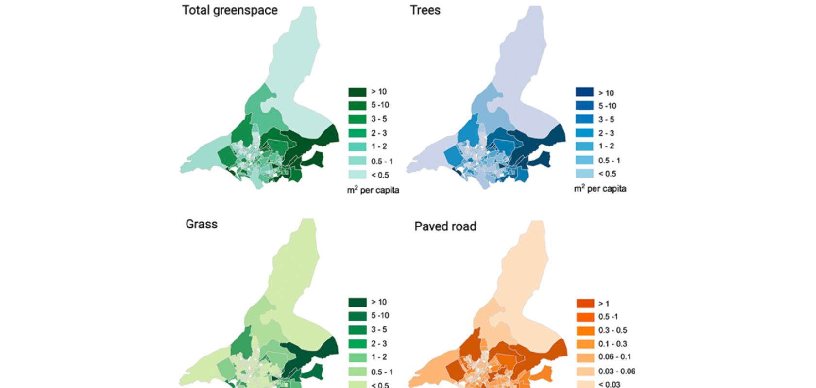
Spatial distribution of total greenspace, trees and grass in sqm per capita, and areas of paved road in Karachi, by union council. Image: NYU Tandon School of Engineering
An AI system developed by NYU researchers accurately maps urban green space in Karachi, Pakistan, exposing severe environmental inequalities but offering a key tool for city planners.
Register for FREE to keep reading
Join 10,000+ vision professionals driving innovation in automation, AI and imaging with:
- Expert insights on vision, robotics, AI & embedded tech
- Newsletters and features covering the full imaging landscape
- Visionaries series: leadership strategies in imaging
- Free panels on smart manufacturing & autonomy
- White Papers & updates for smarter integration
Sign up now
Already a member? Log in here
Your data is protected under our privacy policy.