AI and remote sensing used to map urban building materials for more sustainable smart cities
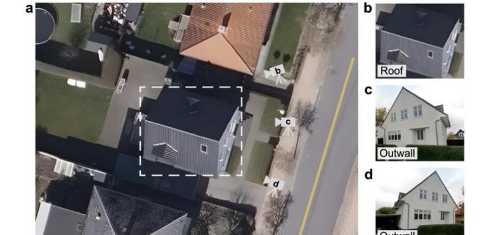
Building materials can be identified by analysing a fusion of visual data from aerial views (a), satellite imagery (b) and Google Street View (c, d). Image: Environmental Science and Ecotechnology
Peking University has collaborated with the University of Southern Denmark (SDU) to identify urban building materials with remote sensing and AI, allowing urban planners to reduce carbon emissions via energy-efficient retrofitting.
Register for FREE to keep reading
Join 10,000+ vision professionals driving innovation in automation, AI and imaging with:
- Expert insights on vision, robotics, AI & embedded tech
- Newsletters and features covering the full imaging landscape
- Visionaries series: leadership strategies in imaging
- Free panels on smart manufacturing & autonomy
- White Papers & updates for smarter integration
Sign up now
Already a member? Log in here
Your data is protected under our privacy policy.