Advanced imaging technologies used to map the frozen Arctic and process frozen tuna
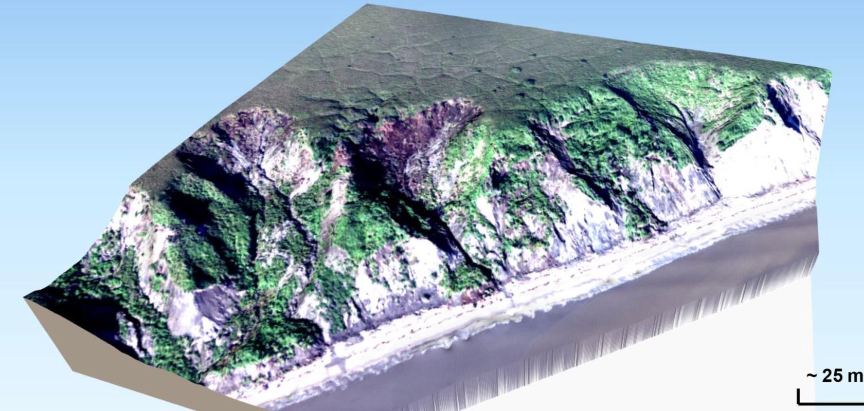
A 3D view of coastal thaw slumps on Baldwin Peninsula. Courtesy of German Aerospace Center and Potsdam University
From tracking the melting rate of Arctic permafrost to optimising frozen tuna processing, cutting-edge imaging technologies are reshaping research and industry.
Register for FREE to keep reading
Join 10,000+ vision professionals driving innovation in automation, AI and imaging with:
- Expert insights on vision, robotics, AI & embedded tech
- Newsletters and features covering the full imaging landscape
- Visionaries series: leadership strategies in imaging
- Free panels on smart manufacturing & autonomy
- White Papers & updates for smarter integration
Sign up now
Already a member? Log in here
Your data is protected under our privacy policy.